MOUNTAIN LEGACY PROJECT

Capturing change in Canada's mountains

About Mountain Legacy Project

The Mountain Legacy Project explores changes in Canada’s mountain landscapes through the world’s largest collection of systematic high-resolution historic mountain photographs (>120,000) and a vast and growing collection of repeat images (>8,000 photo pairs). Find out about our research and how we turn remarkable photos into real-world solutions for understanding climate change, ecological processes, and strategies for ecological restoration. Read more

Eric Higgs, PhD

Director
Office phone:
250-721-8228

E-mail:
ehiggs at uvic dot ca

Environmental Studies, University of Victoria

Mountain Image Analysis Suite (MIAS): A new plugin for converting oblique images to landcover maps in QGIS

The MLP's Claire Wright has been hard at work over the summer, not only with field work, but also with the publication of this most recent paper, and the development of the The Mountain Image Analysis Suite (MIAS) http://doi.org/10.1111/tgis.13229 MIAS is a unique,...

Thinking of you, Jasper

By Eric Higgs, August 8th, 2024 Thinking of You, Jasper. ***** The Mountain Legacy Project (MLP) was born in Jasper. Starting in 1996 with the uncovering of a set of 1915 survey images of the area, we began to realize the power of historical and repeat photographs for...

A Farewell to Fieldwork

    By James Tricker, July 12th, 2024 With MLP fieldwork underway in the mountains this summer, one long-time crew member is (very reluctantly) sitting this season out to instead focus on writing up his dissertation (one last mountain, James). Here, he...

PART 2 – Trying to see the Forest for the Trees: Testing Machine Learning Models on Mountain Legacy Project Images

In part 1 of this series, I discussed the motivation for using machine learning to classify land cover types in Mountain Legacy Project (MLP) images and described convolutional neural networks (CNNs), the technology we use to implement automated classification. This follow-up article tackles some challenges in applying this technology to MLP images and what specific implementations of CNNs we are testing to work toward an optimal solution.

PART 1 – Patterns, Pixels, and Programming: Applying Deep Learning to Mountain Legacy Project Images

Ben Wright, March 21st 2024 This is the first of a two-part series describing the work Aniket Mahindrakar and I have been conducting as research assistants for the Mountain Legacy Project (MLP). For several years now the MLP has been utilizing machine-learning to...

Bison, Reindeer, and Unicorns: Rewilding’s Wild Ride

By Alina Fisher I felt so confused. Not only was I driving on the wrong side of the road, but I also spied a unicorn ahead of me in the valley. I could barely believe my eyes. We were travelling along a narrow gravel road aside the River Freshie. As it wound towards...

Cards For That Special Mountaineer in Your Life

By Kate Fryer Unable to find the perfect card for that mountaineer in your life? Well lovers, we have just the thing! Choose from a fine selection of historic MLP images courtesy of Library and Archives Canada, modern repeats, and even a sneak peak of our ongoing...

Vertical Laboratories: Mountains of Science, Wonder and Devotion

By Sarah Jacobs Generations of scientists, adventurers and poets have found solace and wisdom in mountain places. This essay follows connections between their pursuits to argue that scientific knowledge derives more from risk, wonderment and devotion than is often...

New Publication! Assessing the accuracy of georeferenced landcover data derived from oblique imagery using machine learning.

We are thrilled to announce the latest Mountain Legacy Project research article led by James Tricker: Assessing the accuracy of georeferenced landcover data derived from oblique imagery using machine learning. Published in Remote Sensing in Ecology and Conservation,...

10 Questions for the New Year

Kate Fryer and Sonia Voicescu, January 9th 2024 As we enter the New Year, we wish to unveil a brand new series to the blog that introduces you, dear reader, to the faces of the Mountain Legacy Project: "10 Questions." From postdoctoral fellows to research assistants,...

The Collection

A vast collection of historical mountain photographs created between 1861 and 1958 by surveyors establishing national and provincial boundaries, creating topographic maps, and exploring geological resources

Starting with a series of historical digital images, we puzzle out the exact location of the original surveyors. This is the first step in a chain of complex arrangements that places a repeat photography crew on a mountain summit or ridge… read more

MLP Works

Since its beginning in 1996 MLP Works has provided access to the publications, articles, media, and other scientific and creative products generated through use of MLP techniques and images.
Learn more

Explore

Explore is a map-based search tool designed to allow anyone with a modern web browser to view, compare, and download MLP’s vast collection of historic and repeat images.
Get started

Analysis

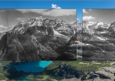
Every image pair can be explored in depth with the Image Analysis Toolkit. IAT supports side-by-side image visualization, including categorization, annotation, scaling, cross and wipe fades, classification statistics, and more.
View the Image Analysis ToolKit

Projects & Galleries

The vast size of our collections means that diamonds—remarkable images that cue into contemporary concerns or historical fascination– are often buried. We present curated galleries that emerge from the work of our teams, whether driven by research questions or personal fascination. Check back regularly for new presentations.

View All Galleries

“In much of the Canadian west these are the first images of these landscapes and a vital baseline for studies of change over the last century. They are invaluable to conservation projects that seek to understand and/or restore pre-settlement landscapes and their dynamic ecosystems.”

Brian Luckman

Professor Emeritus, Department of Geography

University of Western Ontario