Mary Sanseverino, Dec 11, 2020
Here at the Mountain Legacy Project today is something of a big deal. That’s because ever since 2003 the United Nations has declared today – Dec 11 – to be International Mountain Day. It’s a celebration of all things mountain, and every year has a theme. This year’s theme is Mountain Biodiversity, something that MLP’s repeat photography research process shows extremely well.
In fact, we’ve were so excited about this year’s IMD that we started the celebrations early. Thanks in part to our research partners at Library and Archives Canada / Bibliothèque et Archives Canada, every day since Dec 1 we’ve been featuring a new set of historic images, their modern repeats, context images, location maps, and more. We call it the 11 Days of Mountains.
We’ve been using Twitter for this – keeping it short and sweet (as one must on that platform). But, things on Twitter quickly float away on the stream of new entries, so we thought “why not showcase the 11 Days of Mountains together in one place on International Mountain Day!”
So, without further ado let’s get out in the mountains!!!
Day 1: On Cascade Mountain in Banff National Park.
These images are on Cascade Mountain above the town of Banff. So much change to observe. One set shows the town of Banff itself – only a few years old when the historic image was taken. The other set shows Lake Minnewanka and the beginnings of the now submerged town of Minnewanka Landing. These images are also good reminders that this area has been home to First Nations for over 10,000 years.
- Year of historic images: 1888
- Surveyor: James McArthur
- Year of repeat images: 2008
- Location of images: explore.mountainlegacy.ca/stations/828
- Full sized images and more info


Day 2: Overlooking Glacier Bay below the Alaska/BC border.
This historic image is from the 1894 field season of the International Boundary Commission. The IBC survey was tasked with setting the boundary between Alaska, BC, and the Yukon. Today this is in the heart of Alaska’s Glacier Bay National Park and Preserve. Visitors regularly sail up this bay to watch mighty glaciers calve into the ocean.
- Year of historic images: 1894
- Surveyor: Jack Brabazon
- Year of repeat images: MLP hasn’t repeated these yet – but Google Earth gives an idea of what is there today.
- Location of images: Google Maps
- Full sized images and more info


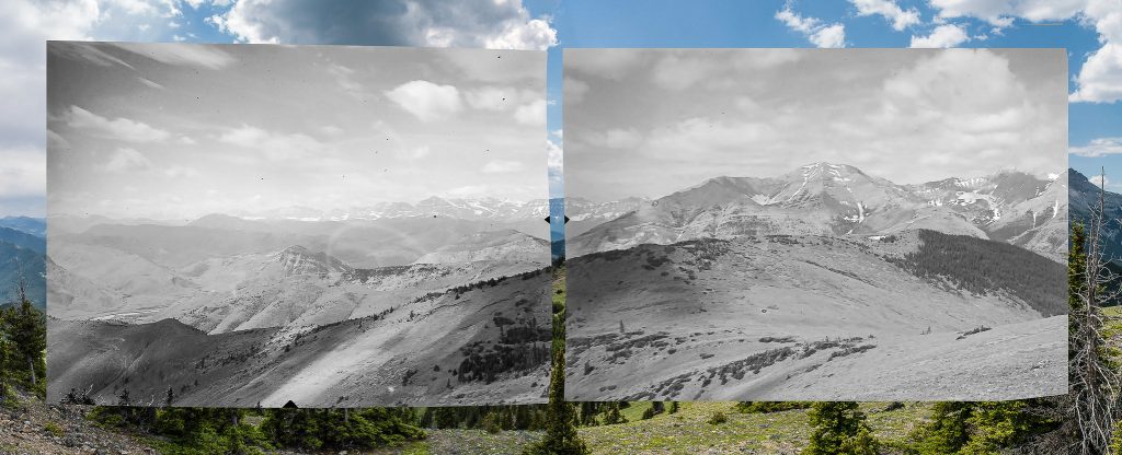
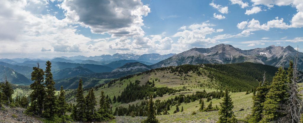
Day 3: Iconic Peyto Lake and Glacier, Banff National Park.
Peyto Lake is one of the most visited spots in Banff National Park. Today you have to be somewhat comfortable of rock and ice to get a view of Peyto Glacier. But, back in 1903 when the historic image was taken, Peyto Glacier was much further down the valley.
- Year of historic images: 1903
- Surveyor: Arthur Wheeler
- Year of repeat images: MLP hasn’t repeated these yet – but team members have been in the area and have provided some context images.
- Location of images: explore.mountainlegacy.ca/stations/1480
- Full sized images, more photos and info
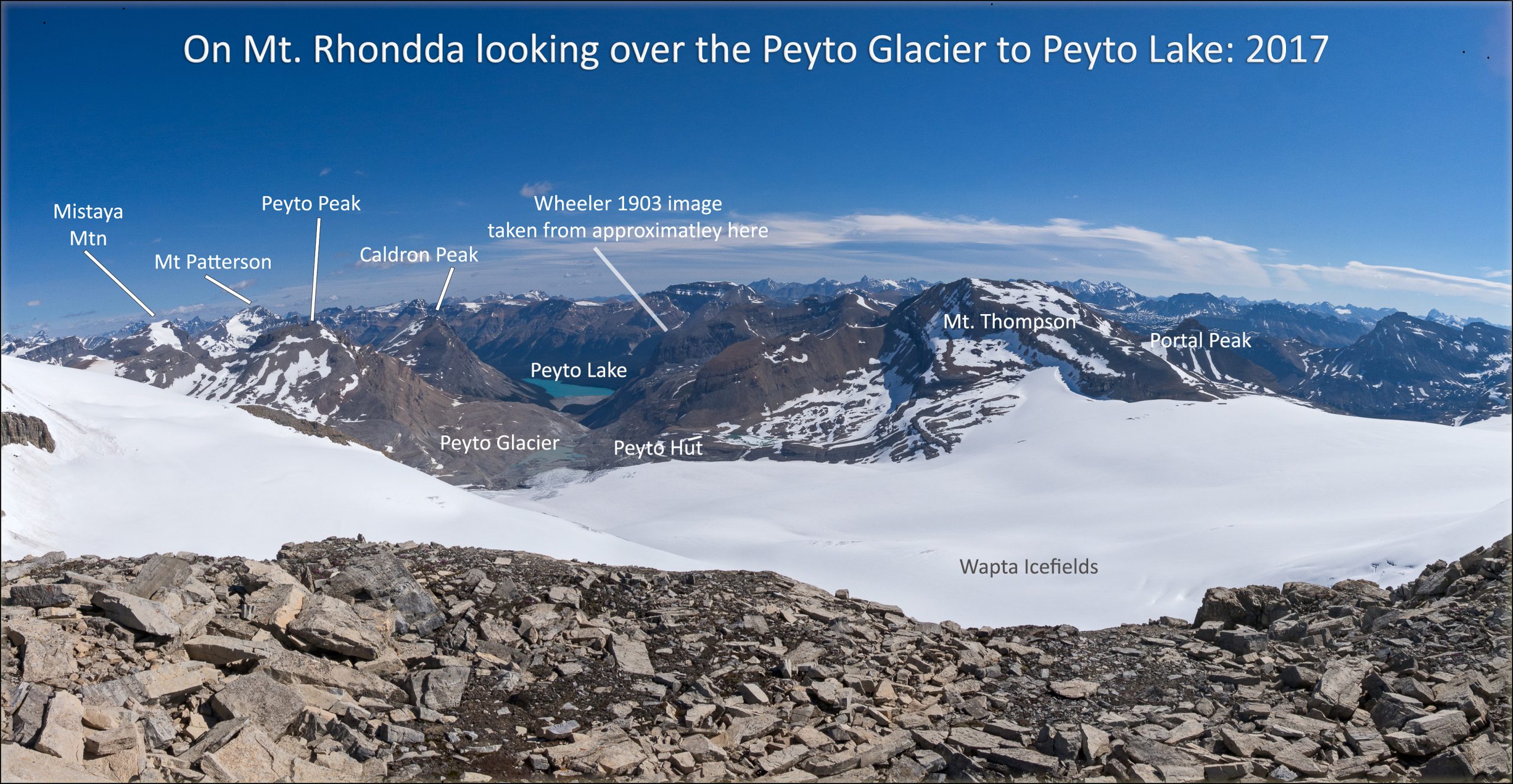
Looking down the Peyto Glacier toward Peyto Lake 
In the Peyto Glacier outwash plain, 2015 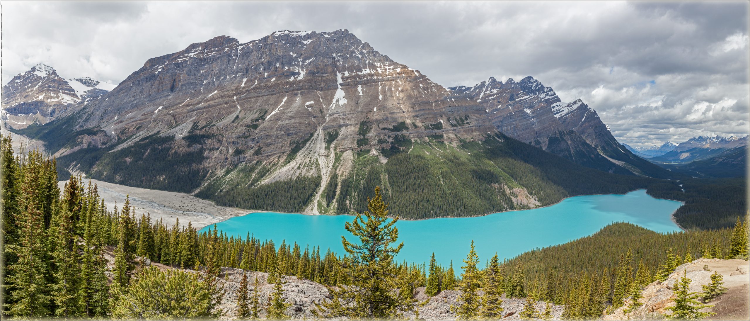
Peyto Lake: 2016 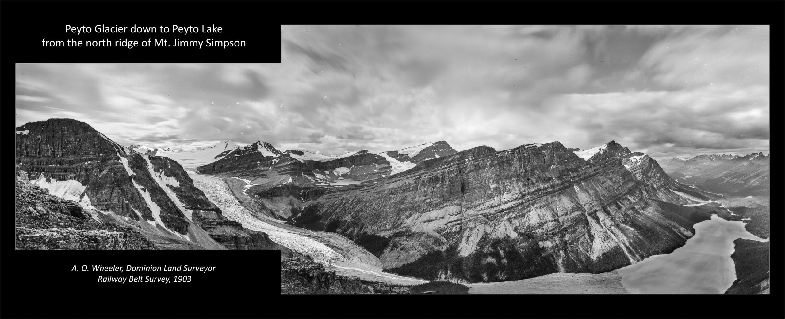
Peyto Lake and Glacier: Arthur Wheeler, 1903
Day 4: Mt. Sir Sandford in BC’s Selkirk Mountains
At 3,519 m (11,545 ft) Mt Sir Sandford is the highest mountain in BC’s storied Selkirk Range. Photos here are from a 1937 survey of the Columbia River and Big Bend and from mountaineer Howard Palmer’s 1909 and 1910 images. The change, especially in glacial ice, is staggering. A special thank you to the Henry S. Hall Jr. American Alpine Club Library for allowing the use of Palmer’s images.
- Year of historic images: 1937, 1909, 1910
- Surveyor: Norman McConnell (1937); Howard Palmer (1909, 1910)
- Year of repeat images: David P. Jones for the Mountain Legacy Project, 2019.
- Location of images: Mt. Stockmer, Above the Ben Ferris – Great Cairn Hut. Below Sir Sandford.
- Full sized images and more info
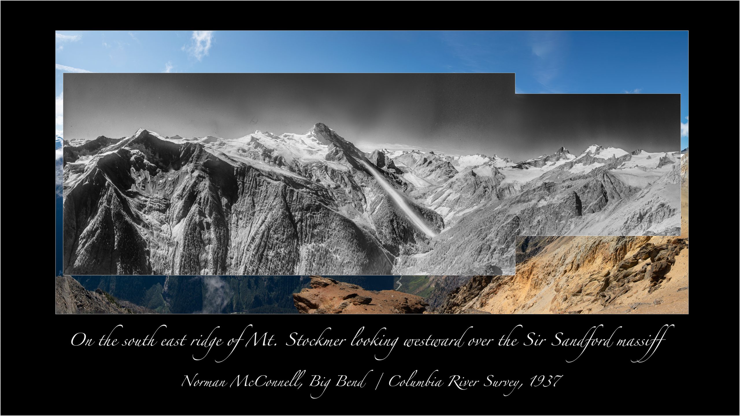
Looking over the Sir Sandford massiff: N. McConnell, 1937 
Looking over the Sir Sandford massiff: David P. Jones for MLP, 2019 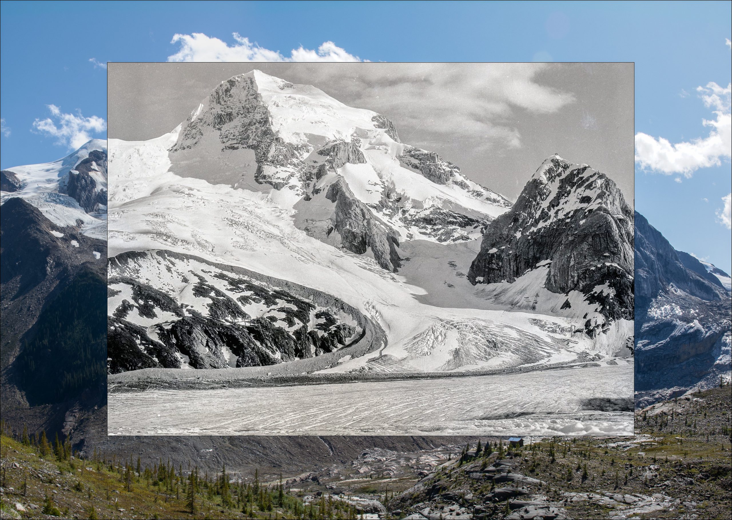
On the Silvertip Glacier looking across at Mt. Sir Sandford: Howard Palmer, 1910 
Above Great Cairn Hut looking at Mt. Sir Sandford: David P. Jones for MLP, 2019 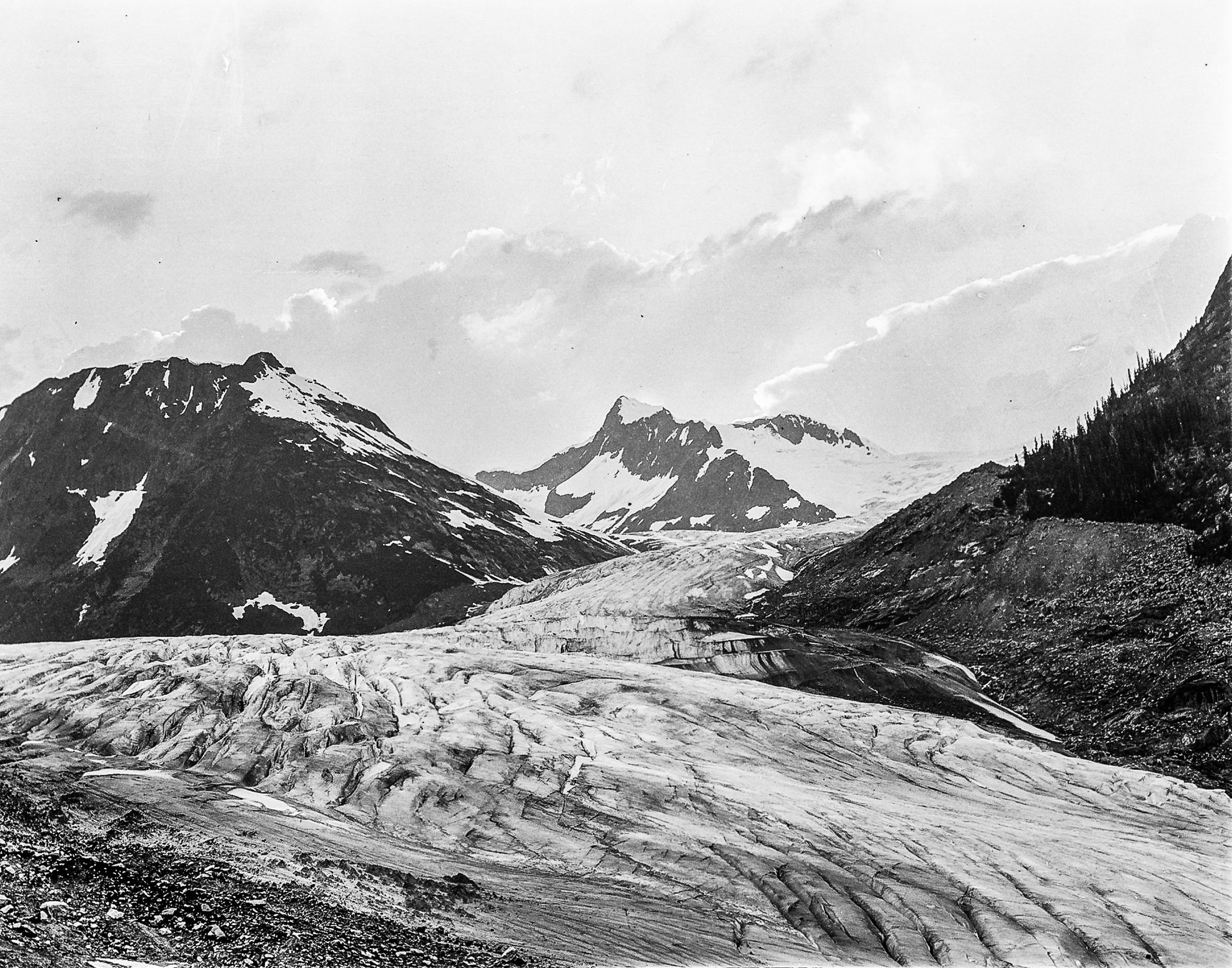
The confluence of Sir Sandford and Silvertip glaciers: Howard Palmer, 1910
Day 5: Wilcox Pass in Jasper National Park
Jasper National Park is full of diverse mountain environments – the alpine treeline ecotone and meadow complex are just a few examples. Want to see something different? With diversity like this you just have to turn around to be amazed!
- Year of historic images: 1917, 1928
- Surveyor: Arthur Wheeler (1917); Morrison Bridgland (1928)
- Year of repeat images: 2011, 2019.
- Location of images: explore.mountainlegacy.ca/stations/289 and explore.mountainlegacy.ca/stations/2455
- Full sized images and more info


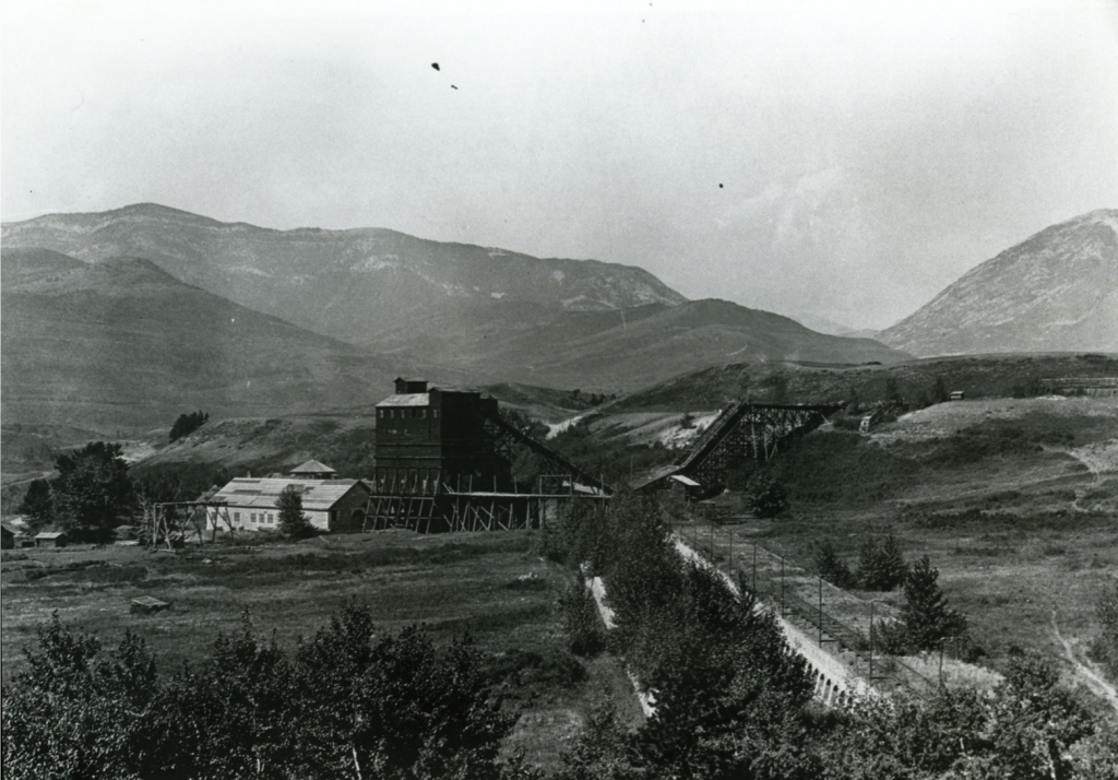
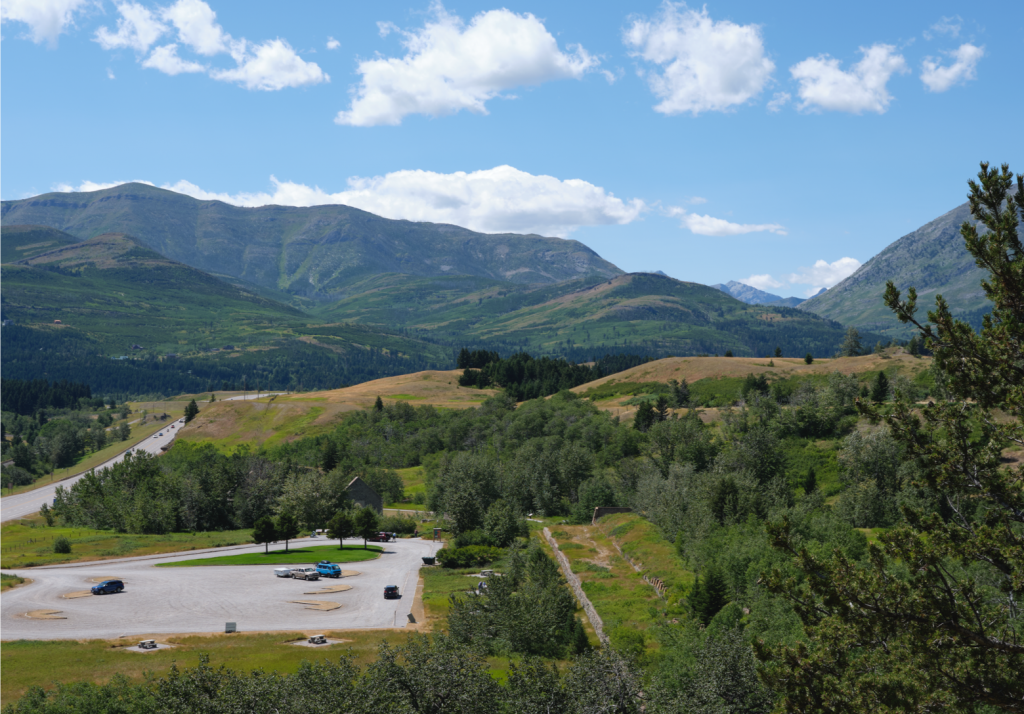
Day 6: Crowsnest Pass, Alberta, with the 2020 MLP field team
COVID-19 put some restrictions on the Mountain Legacy field team. The season in the mountains wasn’t as long and some resources were not available. However, once a safety protocol was designed, approved, and put in place, a small team was able to get out for a few weeks. The images here are part of that work.
- Year of historic images: 1920
- Historic images courtesy of the Crowsnest Museum
- Year of repeat images: 2020.
- Location of images: On Google Maps
- Article by Sonia Voicescu on these images.
Day 7: Bull Creek, eastern slopes of the Alberta Rockies
This image pair looking into Bull Creek shows how dynamic forest changes can be on mountain landscapes. For the past few years MLP has been part of an interdisciplinary project called Landscapes in Motion. LIM is working to discover where, when, and how wildfires have shaped these mountains landscapes, including the roles of humans and climate.
- Year of historic images: 1916
- Surveyor: David Nichols
- Year of repeat images: 2012.
- Location of images: explore.mountainlegacy.ca/stations/1102
- Full sized images, more info, and additional photos
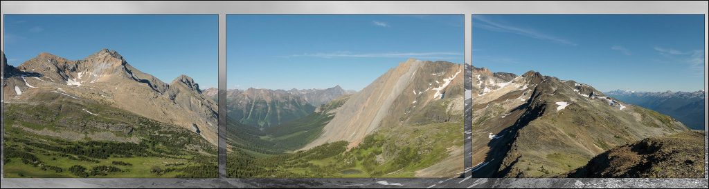
Day 8: Jade Pass, Mt. Revelstoke National Park
Revelstoke is one of BC’s most famous mountain towns. It’s renowned for deep snow, warm summers, mountain culture, and outdoor adventure. It is also renowned for Mt. Revelstoke National Park which looks down on the town and the confluence of the Columbia and Illecillewaet Rivers. The meadow complexes running through this park make it an exceptional area to observe mountain wildflower abundance and diversity. The nickname “Meadows in the sky” is well deserved.
- Year of historic images: 1901
- Surveyor: Arthur Wheeler
- Year of repeat images: repeated these yet – but team members have been in the area getting some context images.
- Location of images: On Google Maps.
- Full sized images, more info, and additional photos

Jade Lake pass looking west, Miller Lake below: 2017J 
Mt Williamson and the Inverness Peaks: 2017 
Upper Jade Lake from Jade Pass: 2017 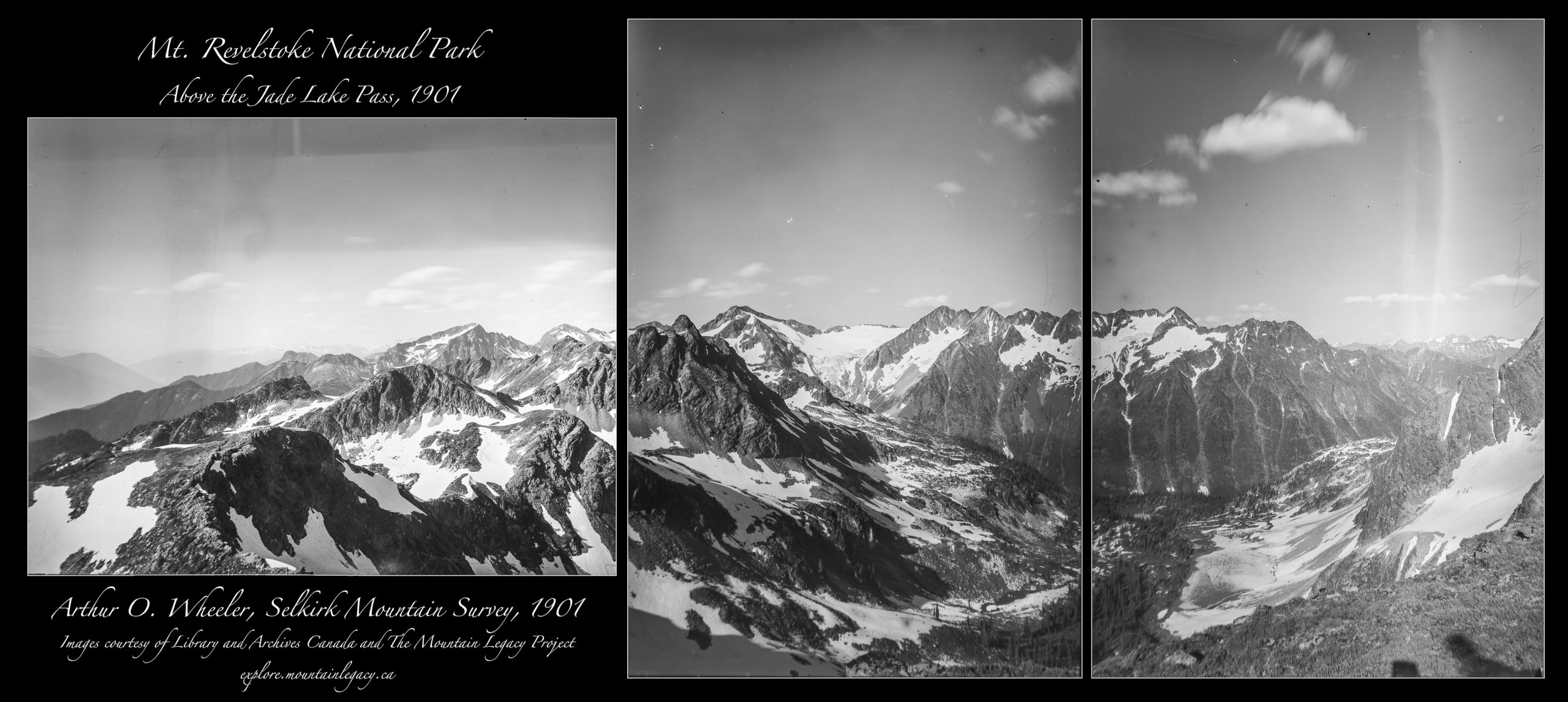
Above Jade Pass: Arthur Wheeler, 1901
Day 9: Mt. Robson and the Yellowhead Pass
At 3954 m (12,972 ft) Mt. Robson is the highest peak in the Canadian Rocky Mountains. It is one of the jewels in the crown of British Columbia’s provincial park system. Mt. Robson is famous for its vertical relief, rising 2975m (9760 ft) from its low point by Kinney Lake. The massif is heavily glaciated with great variation in climate from moist valley bottom to tundra-like high alpine crags.
- Year of historic images: 1911
- Surveyor: Arthur Wheeler
- Year of repeat images: 2011 and 2012.
- Location of images: explore.mountainlegacy.ca/stations/1042, explore.mountainlegacy.ca/stations/1046, and explore.mountainlegacy.ca/stations/1031
- Full sized images, more info, and additional photos


Day 10: Kaskawulsh Glacier and Sockeye Lake – Kluane National Park and Reserve, Yukon
Home to the Champagne, Aishihik & Kluane First Nations, the Yukon landscapes in Kluane National Park and Reserve are vast and dynamic. Images here are of the immense Kaskawulsh Glacier, and, further south, the broad ,richly vegetated valleys of the Kluane Ranges. Change, especially in glaciation, runoff, and rivers, is evident in these photos.
- Year of historic images: 1900
- Surveyor: James McArthur
- Year of repeat images: 2012.
- Location of images: explore.mountainlegacy.ca/captures/7835 and explore.mountainlegacy.ca/stations/1582
- Full sized images, more info, and additional photos


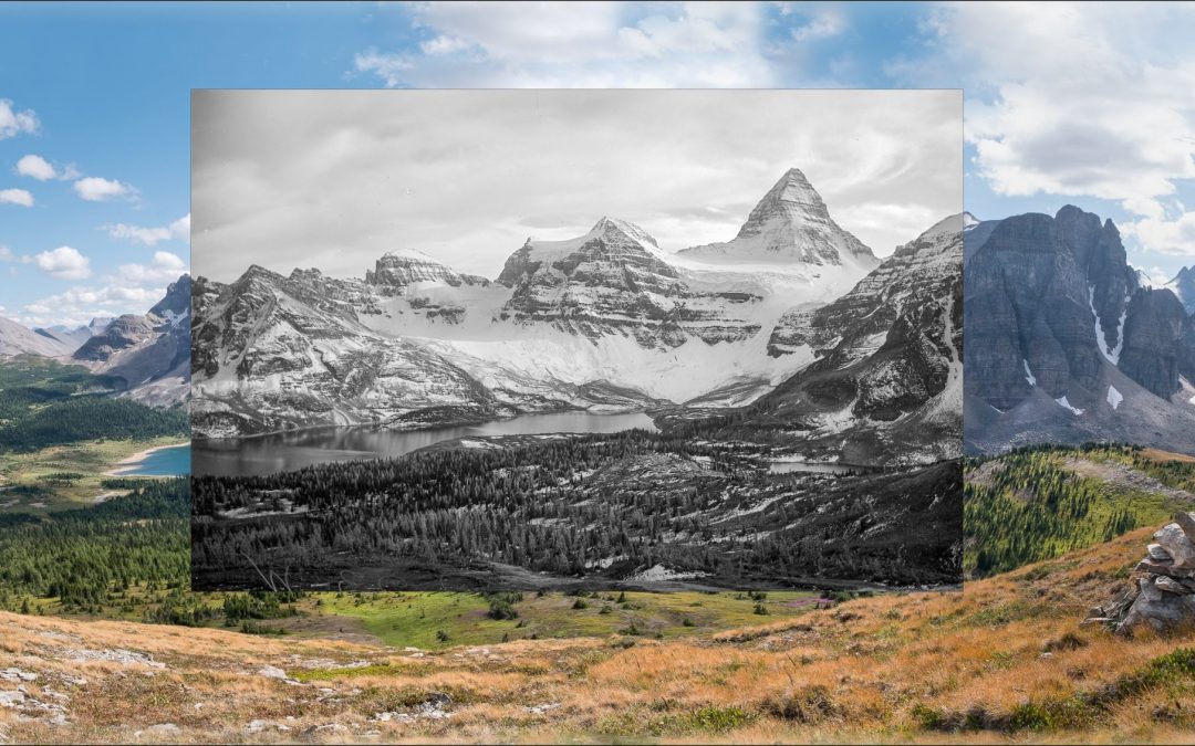
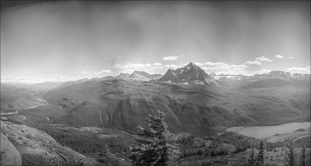
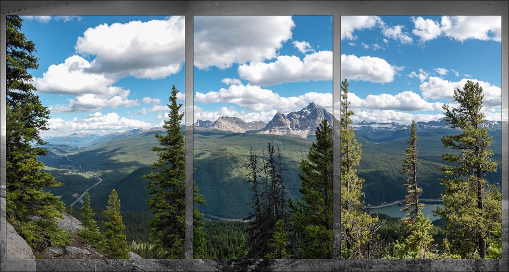
Day 11: Mt. Assiniboine in BC’s Mt. Assiniboine Provincial Park
Recently Canadian Geographic Magazine chose a mountain to represent a range of attributes important in all of Canada’s mountain regions – and Mt. Assiniboine was it! Mountain Legacy was proud to contribute both content and understanding to this project. Read about it here: Iconic Rock!
- Year of historic images: 1913, 1916
- Surveyor: Arthur Wheeler
- Year of repeat images: Mary Sanseverino for MLP, 2017
- Location of images:explore.mountainlegacy.ca/stations/261 and explore.mountainlegacy.ca/stations/2244
- Full sized images, more info, and additional photos


More information
International Mountain Day: UN Days of Observance
Canadian Mountain Network: Why Mountains Matter – Bringing Indigenous Knowledge and Science Together for International Mountain Day
Twitter streams with an International Mountain Day theme:
#MountainsMatter
#InternationalMountainDay
#11DaysOfMountains