Introducing MLP’s first historic mountain images from Canada’s Northwest Territories
The Mountain Legacy Project has long hoped to examine historic glass plate negatives from the Northwest Territories. Last year, while working with research colleagues from Library and Archives Canada | Bibliothèque et Archives Canada at the Preservation Centre in Gatineau QC, our wish was granted! The team appraised 47 images taken from what today is a designated UNESCO world heritage site – Nahanni National Park Reserve | Nah?ą Dehé, NWT, on the traditional territory of the Dehcho First Nations, whose ancestors have called Nah?ą Dehé home since time before memory.
The Mountain Legacy team would like to take this opportunity to introduce you to these stunning images – read on to discover more.
Background to the 1937 Harry Snyder Canadian Expedition to the Nahanni
In 1937 Howard “Fred” Lambart was the surveyor in charge of a three month summer expedition into the mountains along the headwaters of the South Nahanni River. The expedition was financed by Harry Snyder, a wealthy American with experience in the area – but Mr. Snyder was no land surveyor. Indeed, he and Mrs. Snyder only joined the group for 10 days at the end of July. However, his was the money that backed the enterprise, so his was the name on all things related to the expedition – including the glass plate negatives.
Making the 1937 Photo-topographic glass plates
Not only was Fred Lambart a skilled and careful surveyor, but he was a mountaineer with some of the biggest “street cred” of his time. Just a few years earlier in 1925 he was assistant leader on the first ascent of Mt. Logan – at 5,959 m / 19,551 ft the tallest mountain in Canada and 2nd highest in North America.
Lambart’s expedition into the Nahanni, while not, perhaps, quite as epic as Mt. Logan, still had him exploring uncharted territory. The full 1937 complement included Fred Lambert representing the Canadian Geodetic Survey, his field assistant Karl Stein of New York; Colonel A.J.McNab of Chicago; Jim Ross, a Peace River outfitter; Ted Boyton, the cook; and Joe Callao, an assistant. As well as map making, representative animal species were collected for the New York Museum of Natural History and Ottawa’s Victoria Museum.
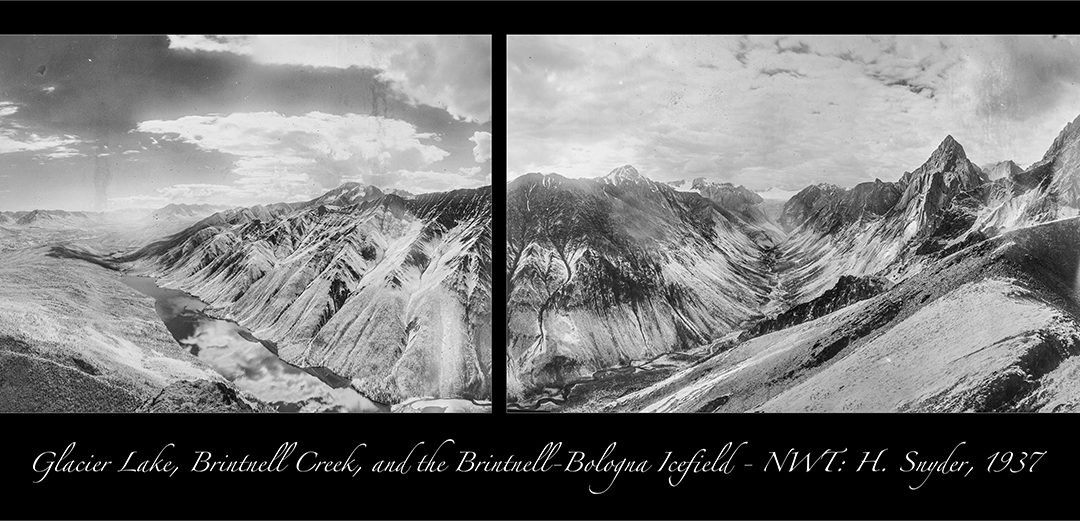
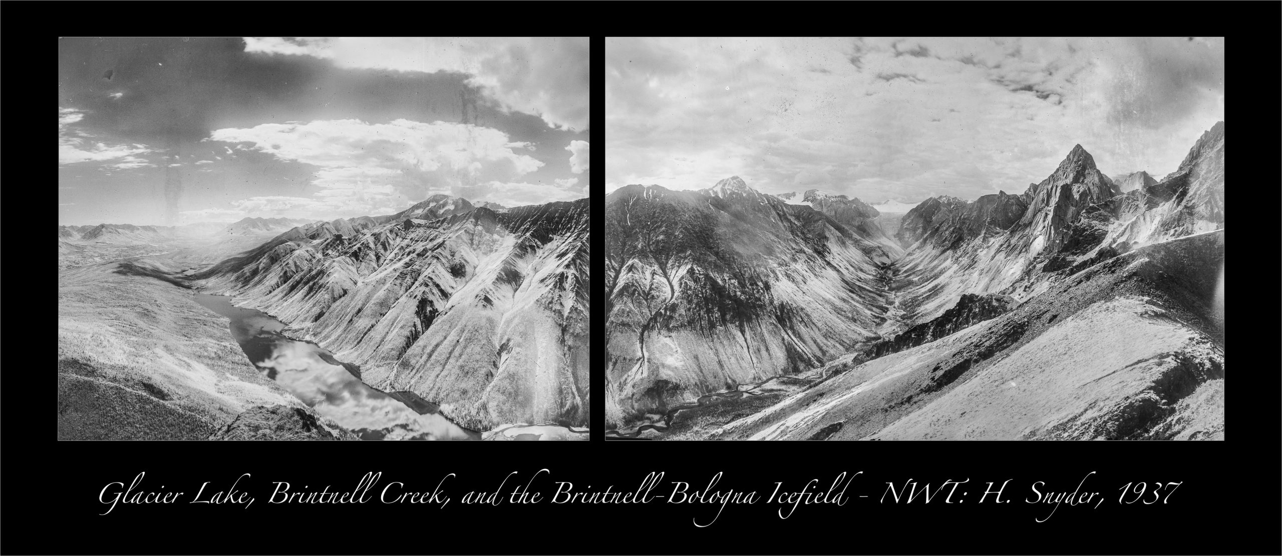
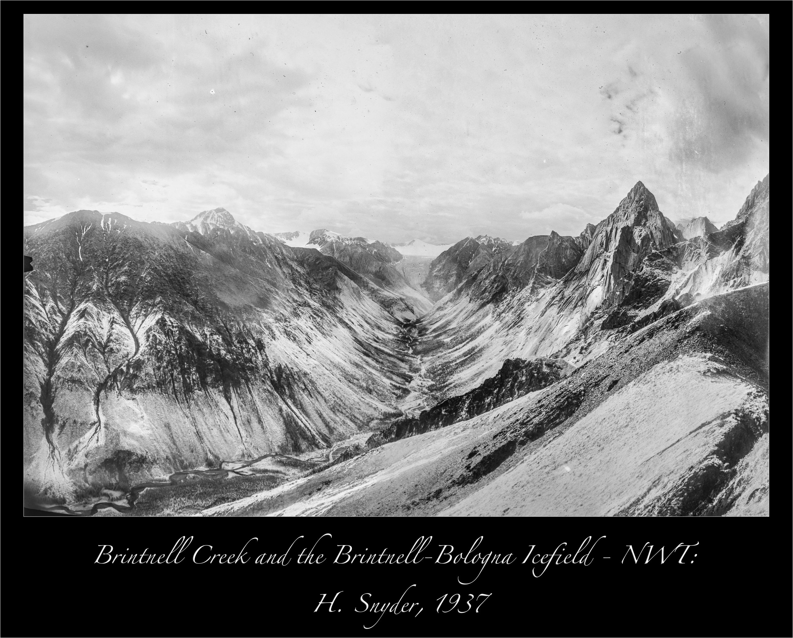
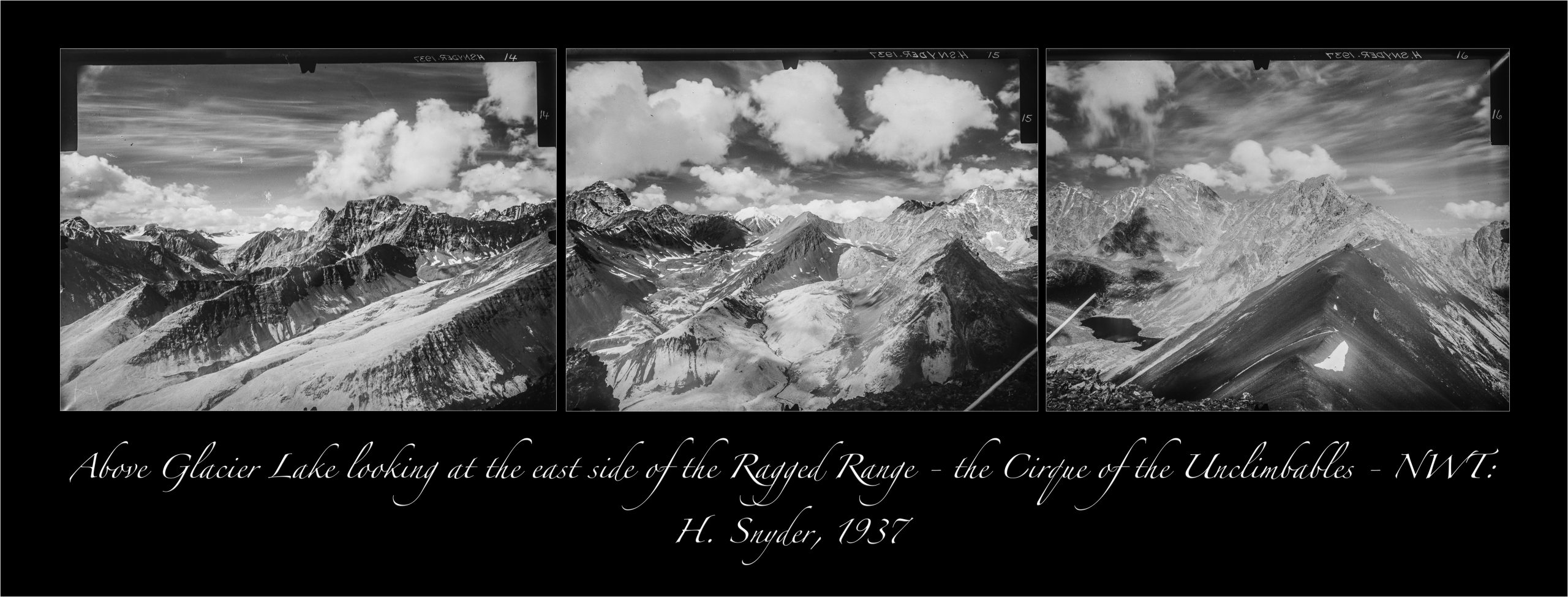
Lambart and Stein occupied seven photo-topographic stations in the ridges above Glacier Lake (shown on the map above and known by some as Brintnell Lake). In all they took 47 infra-red photo-topographic glass plate negatives.The expedition was not blessed with good weather – and it shows in many of the images. But, Lambart made the best of it and managed a number of stunning plates.
His photography is some of the earliest in the area and captures a diverse range of landscapes from broad river valleys to sheer rock faces, from treed lower slopes to the icy reaches of the Brintnell – Bologna Icefield, Some of the images give a first photographic look into the eastern slopes of the mountains that make up the Cirque of the Unclimbables, a bucket-list destination for many of today’s keen climbers and mountaineers.
Repeating the photos
The Mountain Legacy Project has only recently curated these historic images – our first from the North West Territories – into the MLP database so no modern repeat photographs exist as yet. When the repeats are completed, comparing them with these historic 1937 images and looking for indications of what has changed (and what has remained the same) will make for fascinating research.
In the meantime, let’s look at some historic landscape “interpretation” of sorts – a hand coloured lantern slide based on one of Lambart’s survey images. Lantern slides, along with the “Magic Lantern” devices used to project the slide images onto screens, were popular entertainment, especially in the early years of the 20th century. Think of them like today’s Power Point presentations, but with a lot more, shall we say, “enthusiasm” from the audience, because it took time, talent, training, and specialized equipment to produce the slides. Especially so if the slides were hand coloured, as in this example looking down at the Glacier Lake area.

Harry Snyder Canadian Expedition 1937. Glacier Lake from Turret Station, South Nahanni River, NWT. Hand coloured lantern slide. NWT Archives/Canada. Department of the Interior fonds / G-1989-006: 0019

Harry Snyder Canadian Expedition 1937. Glacier Lake from Turret Station, South Nahanni River, NWT. From photo-topographical glass plate black and white negative.
More information
Follow along with MLP and learn more about these images:
- See all the stations in their geographic context at Explore Mountain Legacy.
- Read Fred Lambart’s full report on the 1937 Harry Snyder Expedition to the Nahanni in the online Canadian Alpine Journal’s 1938 edition (thanks to the Alpine Club of Canada for making this resource available!).
- View online annotated copies of the 1937 panoramas.
- Curious about the 1925 ascent of Mt. Logan – read about it at the Virtual Museum.
- Curious about lantern slides – read about it from the Univ. of Southern Florida’s Special Collections.
- More lantern slides from the Harry Snyder Expedition and the NWT in general: NWT Archives
- Visit the MLP Facebook page for quick updates.