The MLP’s Claire Wright has been hard at work over the summer, not only with field work, but also with the publication of this most recent paper, and the development of the The Mountain Image Analysis Suite (MIAS)
http://doi.org/10.1111/tgis.13229
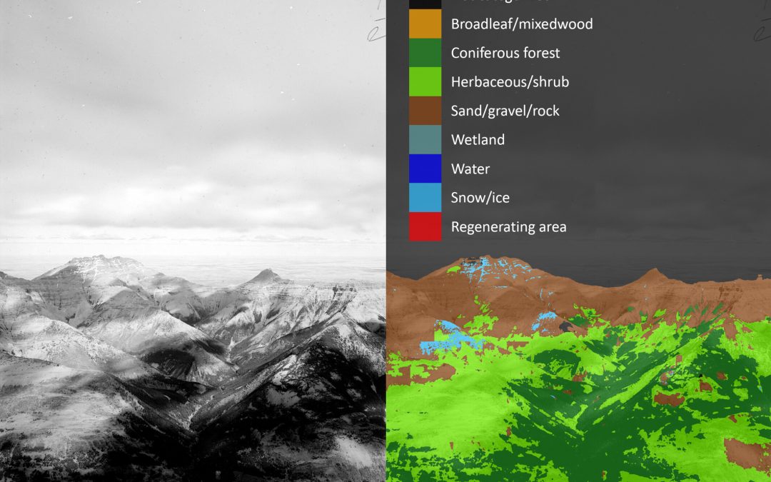
MIAS is a unique, opensource GIS plugin for QGIS that classifies and georeferences high-resolution oblique imagery to create landcover datasets. Developed using images from the Mountain Legacy Project, MIAS employs deep learning models to automate classification and offers a streamlined workflow for image analysis. This innovative tool has diverse applications in fields from mountain research and ecological restoration, to community mapping, environmental planning and beyond!
MIAS can be downloaded from https://github.com/MLP-Hub/MLP_IA_Suite and installed in QGIS using the install from zip option.
Way to go Claire!!