• Facebook
  • X
  • Instagram
  • RSS
Mountain Legacy Project
  • Home
  • The Project
    • About the Project
    • Explore the Photos
    • Image Analysis Toolkit
  • Publications and Recognition
  • Our Blog
  • Newsletter
  • Projects & Galleries
  • Contact Us
Select Page
Mountain Image Analysis Suite (MIAS): A new plugin for converting oblique images to landcover maps in QGIS

Mountain Image Analysis Suite (MIAS): A new plugin for converting oblique images to landcover maps in QGIS

Oct 9, 2024 | Uncategorized

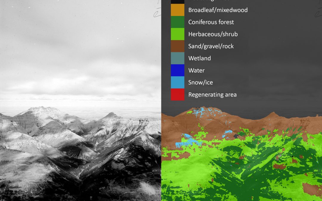
The MLP’s Claire Wright has been hard at work over the summer, not only with field work, but also with the publication of this most recent paper, and the development of the The Mountain Image Analysis Suite (MIAS) http://doi.org/10.1111/tgis.13229 MIAS is a...

Recent Posts

  • Citizen Science on Top
  • 10 Questions with Claire Wright
  • “A Tale of Two Disturbances…” A New Article by James Tricker
  • Blisters, Boulders, and Breathtaking Views: Darcy’s First Field Season
  • Borealis

Archives

October 2024
M T W T F S S
 123456
78910111213
14151617181920
21222324252627
28293031  
« Aug   Dec »

Categories

  • 10 Questions
  • External News
  • Historic photos
  • Indigenous Territory Aknowledgement
  • Just for fun
  • MLP News
  • MLP research
  • Notes from the Field
  • Posts from the past
  • Uncategorized

WE DEPEND ON PARTNERS FOR CRITICAL SUPPORT, INCLUDING:

Mountain Legacy Project
Contact Us