The Mountain Legacy Project (MLP) repeat photography crew spent a week at Waterton Lakes National Park in mid-July. For most of the crew this was a first visit to Waterton; what we saw was a very different landscape than what was there two years ago. In September 2017 the Kenow wildfire burned through Waterton, scorching 38% of the total park area overnight (Parks Canada, 2018). Almost 90% of the affected area burned at high or very high severity. In areas of high severity, the fire burned almost all of the vegetation and organic matter (Odsen, 2018). Although the sight of vast swaths of burnt forest was jarring at first, the landscape we saw was not lifeless. We were greeted by a spectacular profusion of wildflowers which is common after wildfires. As we walked through charred aspen trees, bright purple lupines, geraniums, yarrow, blanket flowers, and many coloured paintbrushes brushed up against our ankles. It was a feast for my artist eyes. Beauty is still ever-present, though it has taken a different form. As a part of the ongoing post-Kenow wildfire vegetation monitoring program, the Mountain Legacy Project did a seven-day repeat-photography blitz to get a look at just how much had changed throughout the park.
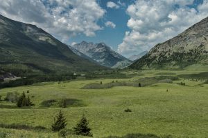
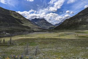
On the first day in Waterton we took care of a few easy-to-access stations including Albert Sheppard’s 1914 Coppermine and Morrison Parsons Bridgland’s 1914 Blakiston Mouth, both a short walk off the Red Rock Parkway. Coppermine had never been repeated, but Blakiston Mouth had been repeated once before by the MLP in 2004. The Blakiston Mouth photograph set is considered a “third view” as it allows us to view the landscape at three distinct moments in history (See photos below). It is an iconic image looking up the mouth of the Blakiston Valley towards the tallest mountain in the park, Mount Blakiston. As you can see in the photos, what was once more open grassland at the turn of the 20th century had been encroached by aspens by the 21st century, and now, post-wildfire, wildflower meadows.

Bridgland’s 1914 historic image looking up the valley at Mount Blakiston, at a station named Blakiston Mouth. At 2910 m, it is the tallest peak in Waterton.

The MLP’s 2004 repeat image of Blakiston Mouth

The MLP’s 2019 repeat image of Blakiston Mouth
On day two the whole crew, which consisted of Eric Higgs, James Tricker, Charles Hayes, Sonia Voicescu, and myself, hiked a steep ridge up to the stations that overlooked Anderson mountain. Both Bridgland and Sheppard took photographs there. As we walked through burnt lodgepole pines and Douglas firs, I couldn’t help but feel like I was still walking through a forest even though it wasn’t anymore, and it’s uncertain it will turn back into one any time soon. There are multiple factors that come into play when considering whether a forest will regenerate after a fire. For Douglas-firs, the distance to a living seed source is an important driver of regeneration; fires that create large patches of burned area mean that seed sources may be further away, thus taking longer to establish in hard to reach areas. For lodgepole pines which are serotinous, meaning their cones need the heat from fire to open and germinate, distance to a living seed source is not as important. A main factor affecting regeneration for lodgepoles is whether another fire occurs before the seedlings can reach maturity and develop new cones (Hansen et al., 2018; Kemp et al., 2016). And of course, all regeneration is occurring in the context of rapid climate change, which adds uncertainties to the mix. Waterton is primed to be a fascinating place for post-fire vegetation research to occur, and researchers from many disciplines, agencies and universities are participating.
After hiking down the ridge from Mount Anderson to the Red Rock Parkway, we set off in the early evening on an eight kilometre hike to Snowshoe Cabin, one of Waterton Lake National Park’s backcountry patrol cabins. It is tucked away in the northwest corner of the park. We arrived to the cabin just after darkness fell. I felt grateful for headlamps, but also a part of me felt like the giant white beargrass tufts would have illuminated the way for us.

Cassandra outside the Snowshoe cabin. Miraculously, the cabin and surrounding forest was spared by the Kenow wildfire. Photo Credit: Sonia Voicescu.

Beargrass abounds!
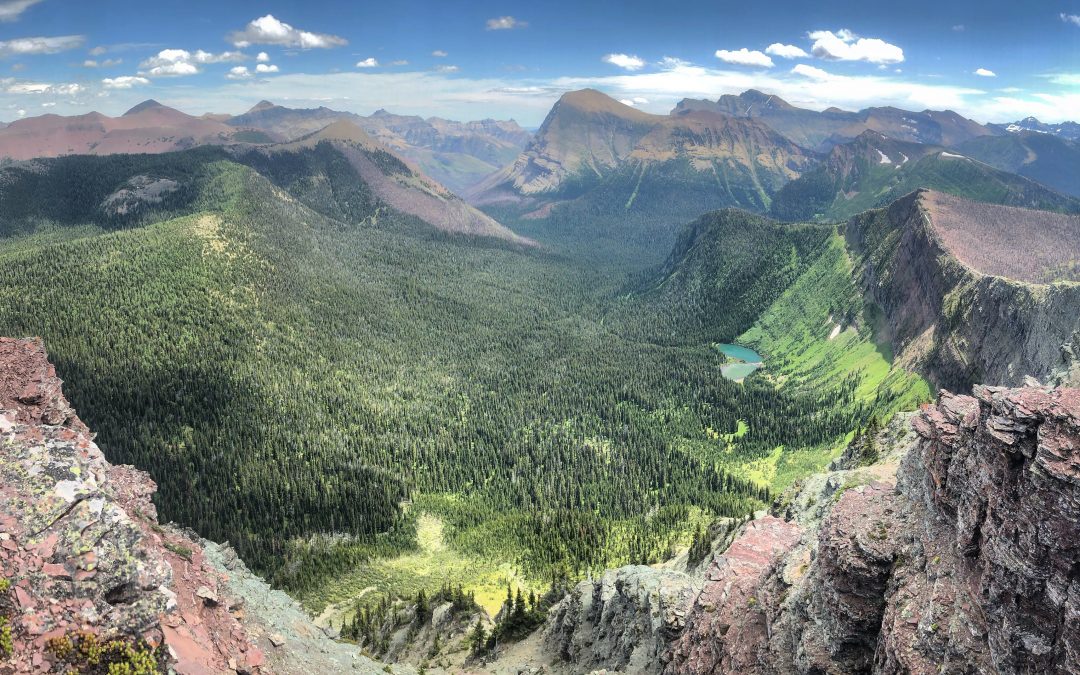
Being based at the cabin for two nights allowed us to do the stations at Sage Creek and Avion Ridge. Sonia, Eric and I enjoyed the deceptively gentle sloped trail to Avion Ridge; we gained significant elevation. Charles and James enjoyed a not-so-gentle, but still spectacular, hike up to Sage Creek. Both stations had good views of where the Kenow wildfire had stopped burning as it moved down the Blakiston Valley, sparing some forest in the northwest corner of the park where the Snowshoe cabin was located. It was both reassuring and mournful at times walking through the unburned forest. It was reassuring that the ecological legacy of flora and fauna in the unburned forest will influence the rest of the Park in decades to come. It was mournful in that so much of it was lost in other parts of the park. I think we could all agree that the views we got from up there were profound.

Sitting at Sage Creek on the divide, overlooking the Lost Lakes. You can see burned patches in the distance. Photo Credit: Charles Hayes.
Thanks to the generous support of Parks Canada we had helicopter support for a day to reach some high priority and more remote and difficult stations that would have otherwise eluded us on this trip. We split into two crews, and we had with us Kimberly Pearson, an ecosystem scientist and our main contact with Parks Canada in Waterton, and Rob Watt, a retired Waterton warden and long-time Mountain Legacy Project collaborator. Combined, the crews repeated Bridgland’s 1914 Cameron South, Cameron Bend, Crandell 1 & 2, Lost Mountain and Blakiston Mouth stations, and both Wheeler and Shepard’s Festubert station. Festubert is on the continental divide, which allowed us to peek into British Columbia to see where the Kenow wildfire started. In BC the fire burned with more mixed severity, with some forest burning at high severity and some at lower severity. As a result, the burn pattern was patchier in BC compared with the extensive patches of very high severity that occurred in Waterton. From Festubert we also saw some portions of the burned area in Waterton that had very little regeneration compared to some of the surrounding area – a stark contrast to the bountiful wildflowers in the foothills. It offered us all a chance to reflect on the significance of what occurred in Waterton only 2 years ago. Rick Arthur, a longtime MLP collaborator and retired fire specialist with Alberta Agriculture and Forestry, Sonia, Eric, and new graduate student, Maya Frederickson noted the patchy regeneration in their hike a few days later to Lakeview Ridge, one of the last significant promontories on the eastern border of Waterton with the Province of Alberta. Here, more than just about anywhere else in Waterton, the mountains change abruptly to prairies, and the Kenow wildfire burned well into the Alberta landscape outside Waterton Lakes National Park. Significant burnt patches showed virtually no evident regeneration after two years, while other areas on the Lakeview ridge showed varying level of regeneration.
I thank Waterton Lakes National Park staff, especially Kimberly Pearson, for all the insights shared about the changes that have happened in Waterton and logistical support. Kim allowed us to completely take over her office while we were processing images and preparing for the next day’s work. Also thank you to Michelle Elliot who organized our stay at the Snowshoe cabin and set us up with gate keys, park passes, and radios. Lastly, a big thank you to Rob Watt for sharing his deep knowledge and experience about the Mountain Legacy Project and the Rocky Mountains as a whole. It was an honour to spend time in Waterton Lakes and I’m looking forward to going back next year for round two!

Rob Watt, Kimberly Pearson, and myself, from my visit to Waterton in May 2019.
References
Hansen, W. D., Braziunas, K. H., Rammer, W., Seidl, R., & Turner, M. G. (2018, April 1). It takes a few to tango: Changing climate and fire regimes can cause regeneration failure of two subalpine conifers. https://doi.org/10.1002/ecy.2181
Kemp, K. B., Higuera, P. E., & Morgan, P. (2016). Fire legacies impact conifer regeneration across environmental gradients in the U.S. northern Rockies. Landscape Ecology, 31(3), 619–636. https://doi.org/10.1007/s10980-015-0268-3
Odsen, S. (2018). Looking back on the Kenow Wildfire: Reflections from a Parks Canada Scientist. Retrieved August 10th, 2019, from Landscapes in Motion website: https://www.landscapesinmotion.ca/updates-1/kenow-wildfire-year-later
Parks Canada Agency (2018, April 4). Kenow wildfire – A Look back at the Kenow Wildfire. Waterton Lakes National Park. Retrieved August 10 2019, from the Government of Canada website: https://www.pc.gc.ca/en/pn-np/ab/waterton/securite-safety/feu-fire-kenow
More information
- To learn more about the Kenow wildfire, visit the Parks Canada website or the Landscapes in Motion blog.
- See all the stations in Waterton Lakes National Park in their geographic context at Explore Mountain Legacy.
- Visit the MLP Facebook page for quick updates.

